
Rusni, Nur Aulia and Hj. Mohd. Noor, Norzailawati and Abdullah, Alias and Isoda, Setsuko (2017) Controlling leapfrog sprawl with remote sensing and GIS application for sustainable urban planning. In: The 2nd International Conference on the future ASEAN (ICOFA 2017), 15-16 August 2017, UITM Perlis. (Unpublished)
![[img]](https://irep.iium.edu.my/style/images/fileicons/application_pdf.png) |
PDF (paper)
Restricted to Repository staff only Download (529kB) | Request a copy |
|
|
PDF
Download (255kB) |
|
![[img]](https://irep.iium.edu.my/58080/8/Parallel_afiq_aulia_Marina.jpg)
|
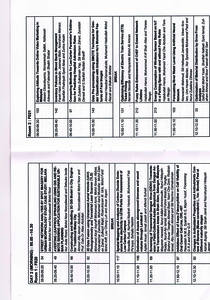
PDF (schedule)
Download (1MB) | Preview |
|
![[img]](https://irep.iium.edu.my/58080/9/Easychair_ICOFA.jpg)
|
PDF
Download (76kB) | Preview |
Abstract
This paper aims to measure and characterised urban sprawl development in Kuala Lumpur city using leapfrog geospatial indices. The researcher utilised remote sensing satellite data such as Landsat and Spot images for two different times. The remote sensing application was subsequently integrated with GIS database to detect changes and analyse the pattern of growth for urban areas in Kuala Lumpur. From the finding of land use change detection, the leapfrog sprawl index was calculated by using geospatial indices formula. The results proved that Kuala Lumpur is the most highly developed city in Malaysia with new development are leapfrogging towards the periphery of the city and infill development pattern seemingly increase vastly filling up the leapt areas cause by leapfrog sprawl. Improper planning will create this type of urban sprawl that is predicted to expand beyond the border towards other states locating adjacent to Kuala Lumpur which is now called Greater Kuala Lumpur. The current scenario has become an absolute threat towards Malaysia planning goal to achieve sustainable urban planning development.
| Item Type: | Proceeding Paper (Plenary Papers) |
|---|---|
| Additional Information: | 6608/58080 |
| Uncontrolled Keywords: | Urban Planning, Urban sprawl, Change detection, Remote Sensing GIS, Leapfrog geospatial indices. |
| Subjects: | G Geography. Anthropology. Recreation > G Geography (General) H Social Sciences > H Social Sciences (General) H Social Sciences > HD Industries. Land use. Labor T Technology > T Technology (General) |
| Kulliyyahs/Centres/Divisions/Institutes (Can select more than one option. Press CONTROL button): | Kulliyyah of Architecture and Environmental Design > Department of Urban & Regional Planning |
| Depositing User: | Dr Norzailawati Mohd Noor |
| Date Deposited: | 31 Dec 2017 00:55 |
| Last Modified: | 28 May 2021 11:22 |
| URI: | http://irep.iium.edu.my/id/eprint/58080 |
Actions (login required)
 |
View Item |